


What it contains
Positions, trajectories, lanes, movement zones, events and infrastructure state.
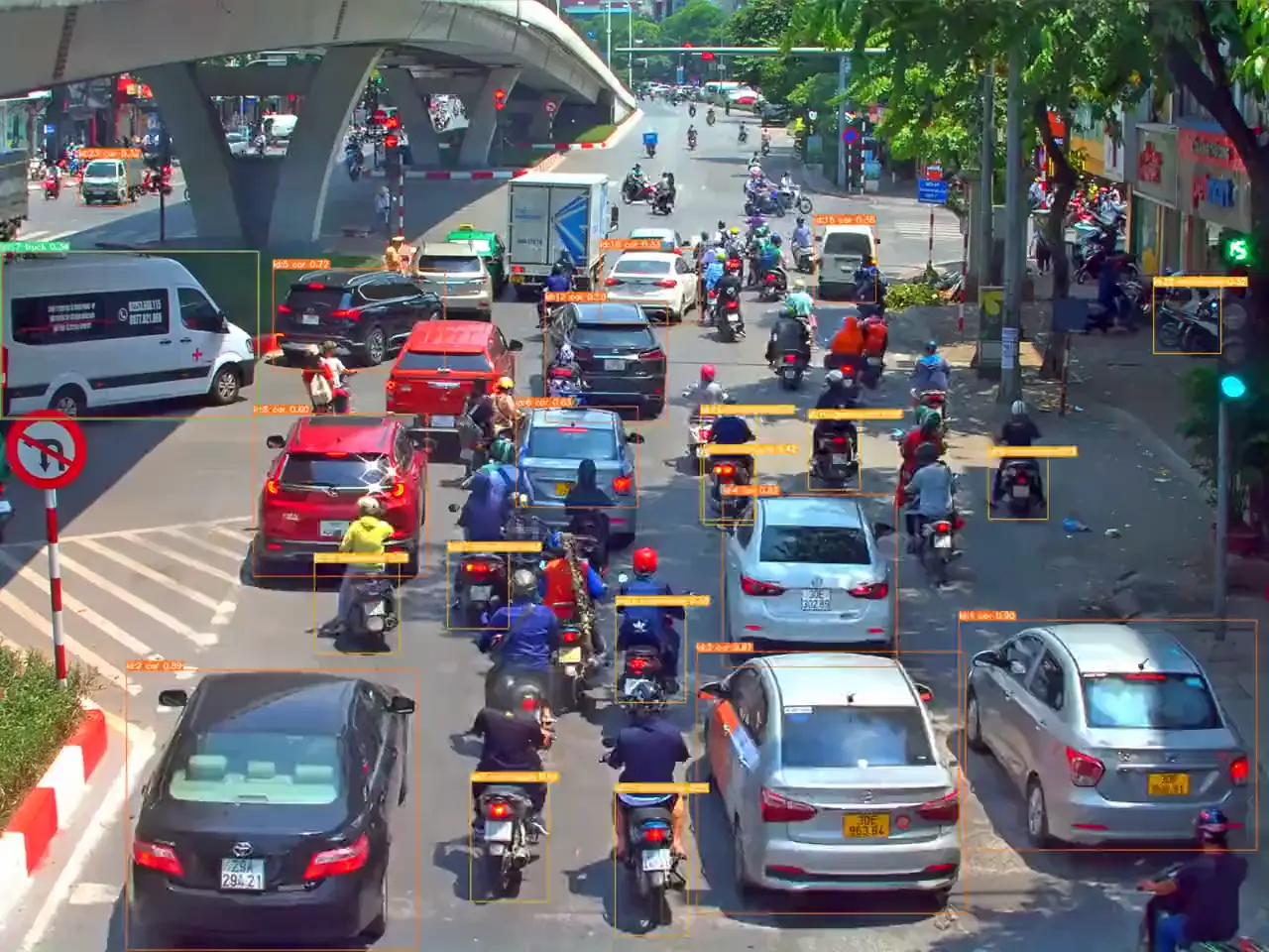
TeraFlow connects roadside sensors, 3D perception and tracking to show what is happening and how traffic is changing.
CAMERA + LIDAR
EDGE PROCESSING
3D TRACKING
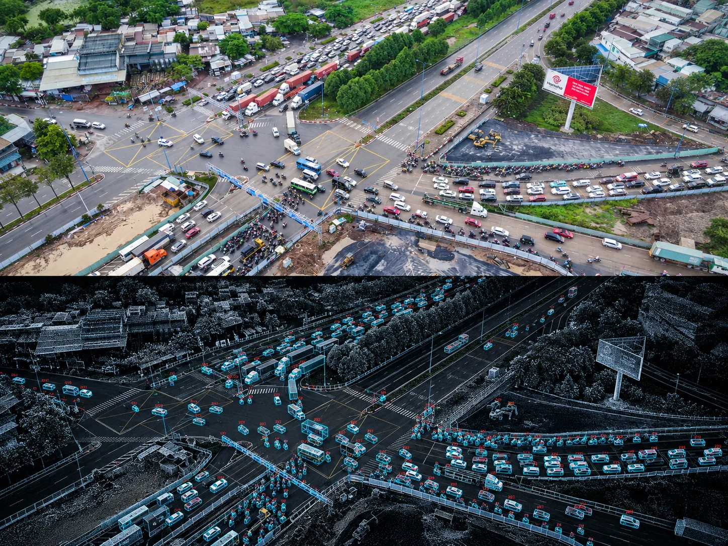


Camera provides appearance. LiDAR provides geometry and depth.
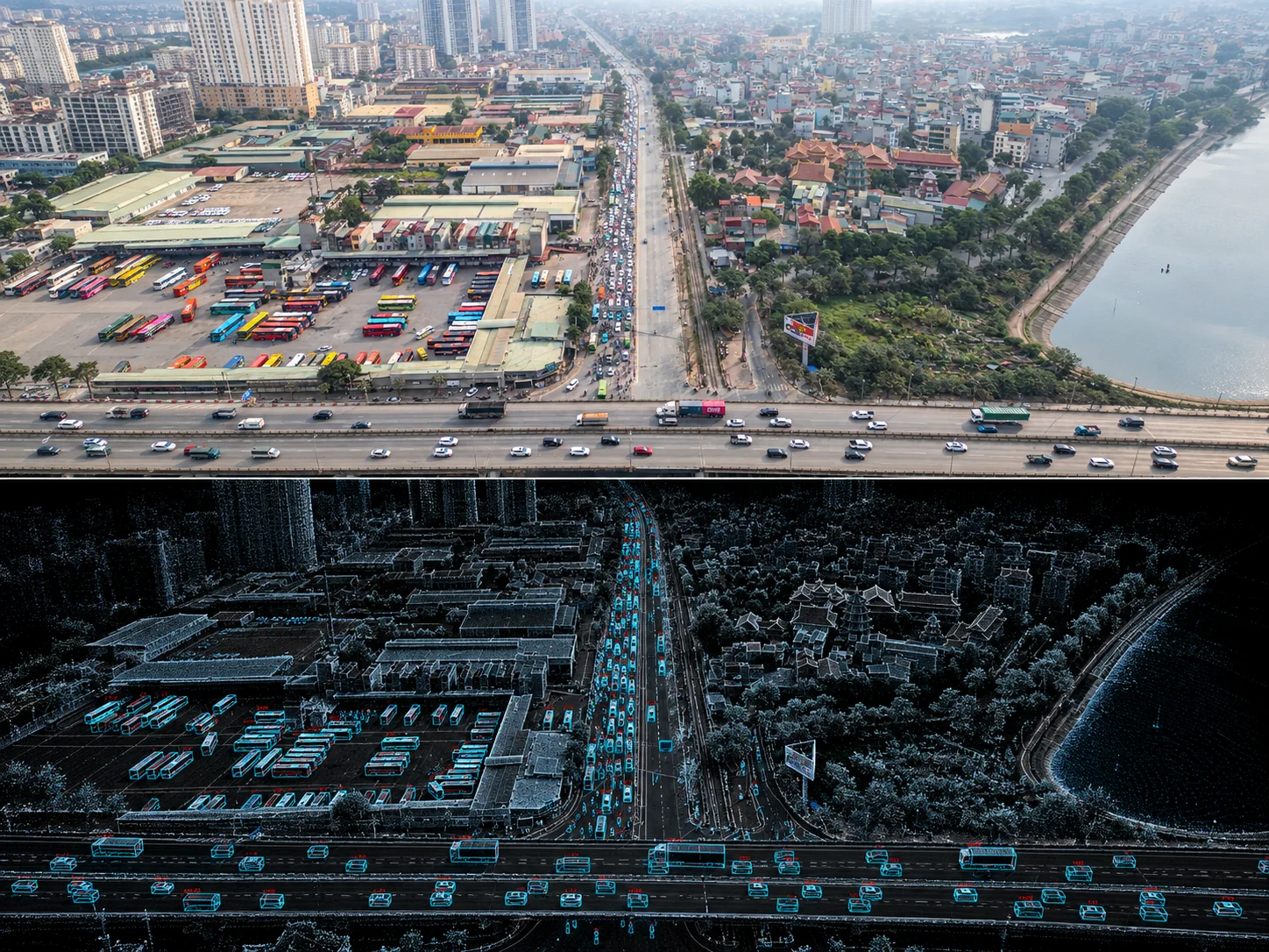
TeraFlow combines camera and LiDAR into a traffic view that can be measured, replayed and reviewed.
TeraFlow ResearchPerception → Twin → Decision Support
Continuous traffic-state awareness
Camera and LiDAR sensor fusion
Vehicles, pedestrians, cyclists and transit
Local perception and event filtering
Works with existing traffic systems
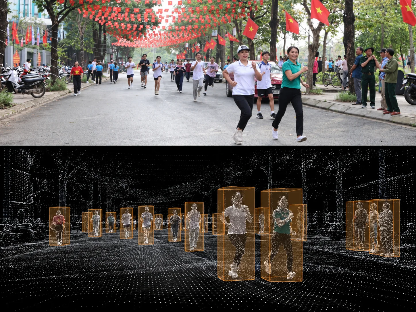
TeraFlow can process perception at the edge, limit retention and provide operational views that focus on movement rather than identity.
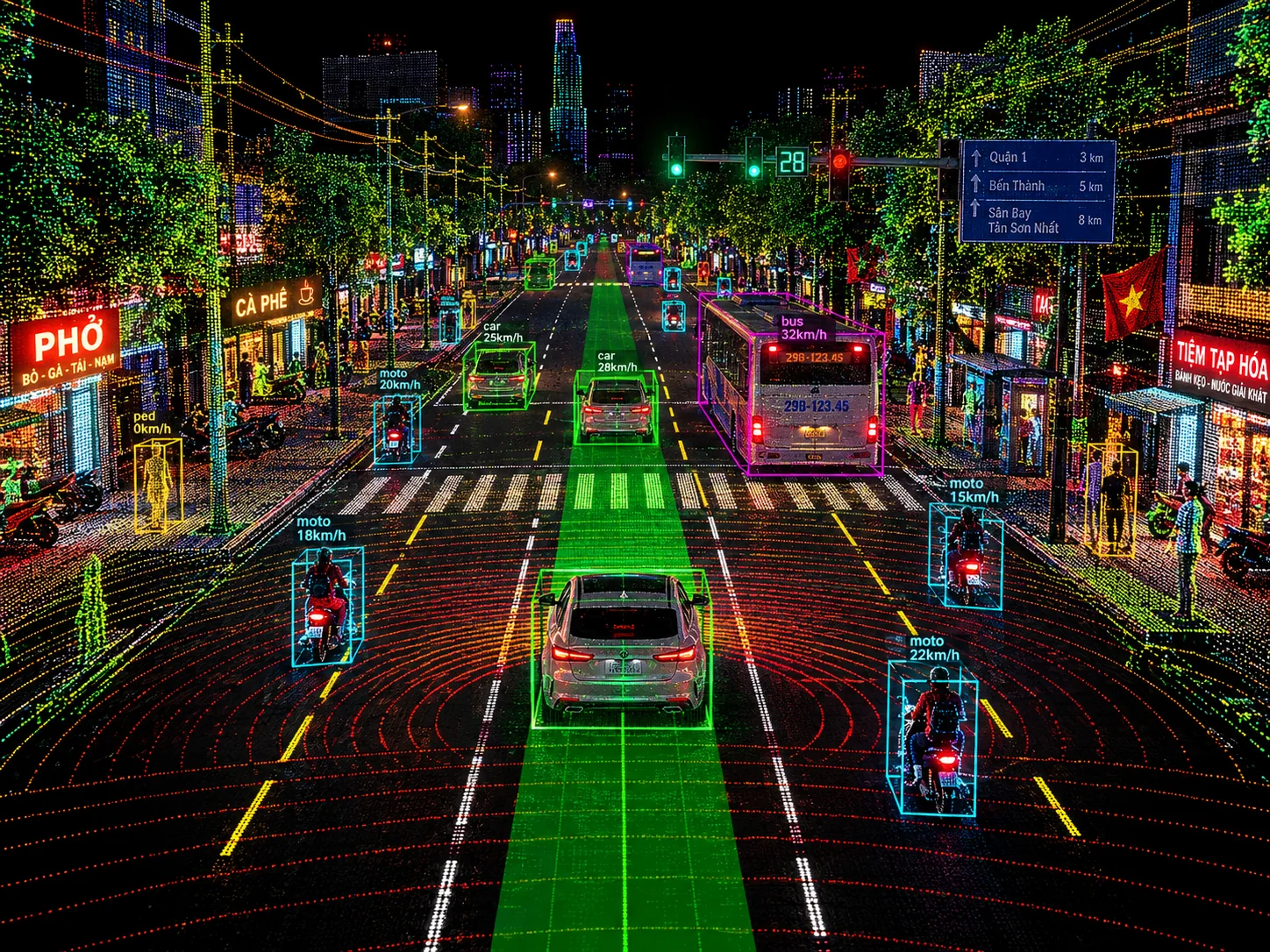
TeraFlow continuously rebuilds road activity into a spatial traffic model.
Vehicles, motorcycles, pedestrians, lanes, movement and events stay connected across camera footage, 3D perception and historical playback.
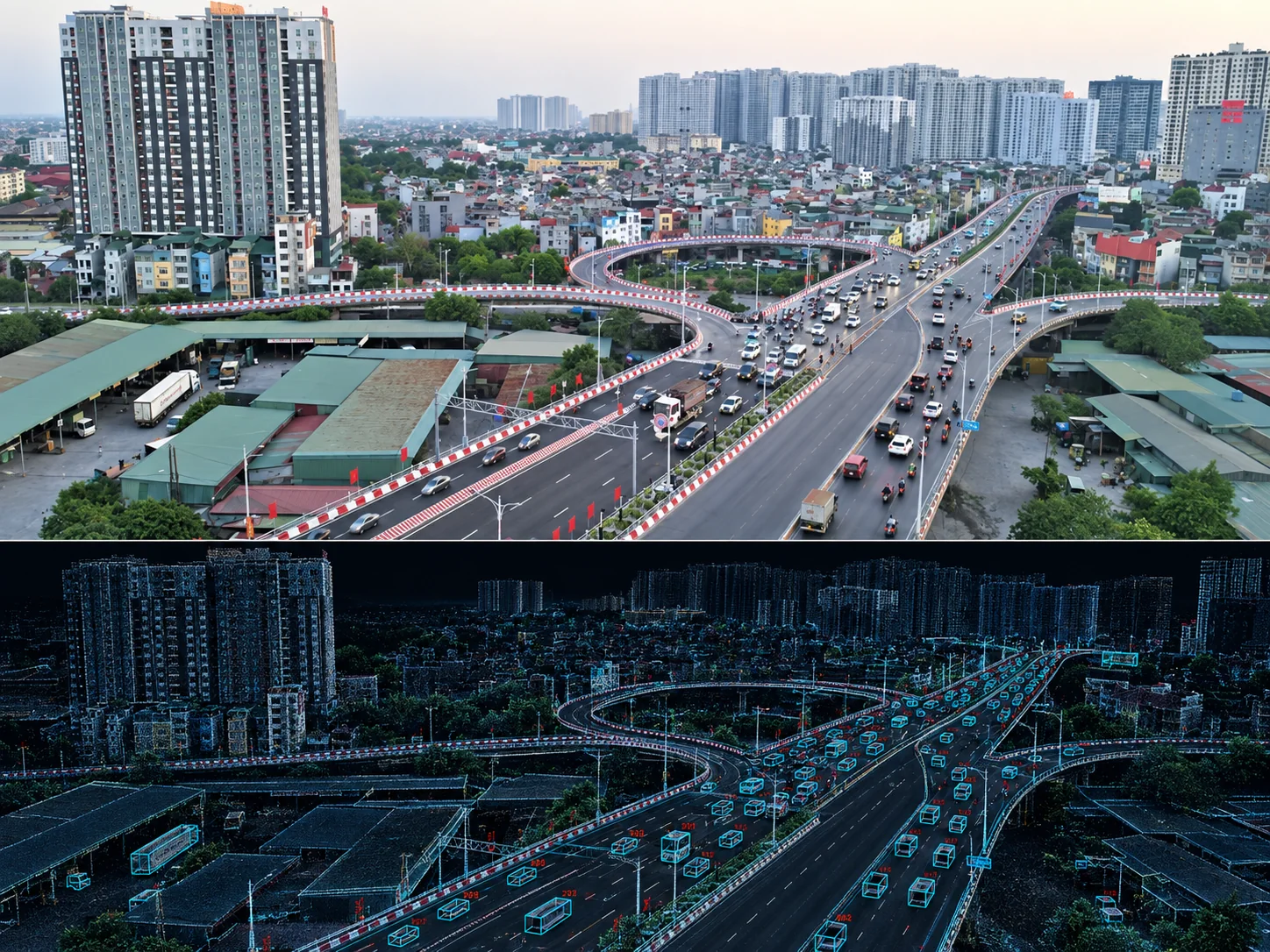
TeraFlow engineering principle
Monitor live traffic, inspect incidents and review site health across multiple locations.
Move between camera, 3D traffic context and recorded events without losing context.
Traffic digital twin
The twin connects accepted observations into one spatial traffic state.
Positions, trajectories, lanes, movement zones, events and infrastructure state.
Low-confidence or rejected observations remain visible instead of being silently merged.
The model reflects what selected sensors observe within documented coverage.
Operators configure the movements and events they need to monitor.
Review recorded scenes, trajectories and events with source and time retained.
Set data retention, processing location and authorized roles by project.
Signal control, V2X messages and physical actions require separate integrations.